Loading
The Making of the Eastern Province
A monumental sculptural timeline documenting the transformation of Saudi Arabia's Eastern Province between 1985 and 2013.
This project transforms decades of urban growth into a unified visual language carved in stone. Using architectural abstraction, infrastructure mapping, and sculptural bas-relief techniques, it interprets transformation itself rather than illustrating history through traditional imagery.
Cities merging into metropolitan systems. Highways carving structure through desert landscapes. Industrial networks expanding toward the Gulf. Ports connecting the Kingdom to the world. Regional systems evolving into a modern urban organism.
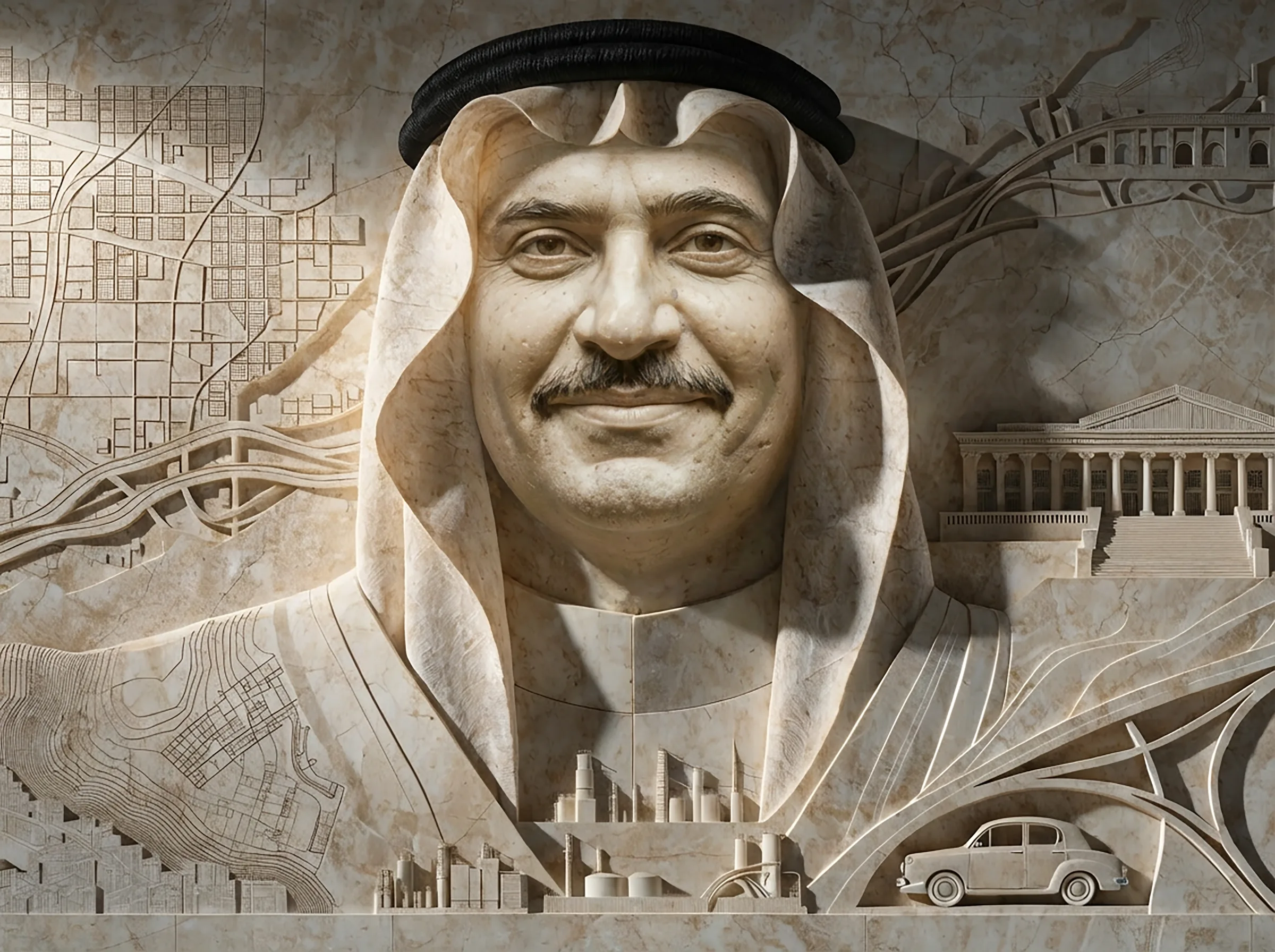
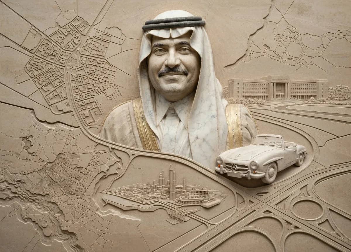
The visual language is intentionally restrained: monochrome surfaces, precise geometry, controlled depth, and infrastructure rendered as sculptural hierarchy. Roads become carved channels. Urban blocks become raised masses. Pipelines become directional systems flowing toward the coast. The result is not a literal map, but a physical interpretation of leadership, planning, and transformation across nearly three decades of development.
Each composition is both an artwork and an engineered object
Every piece is designed to exist as monumental wall installations, carved stone panels, museum-scale reliefs, architectural maquettes, CNC-milled sculptures, engraved metal and hand-finished artworks.
Stories are learned through discussion and memories translated into a lasting visual legacy.
The Six Chapters
1 · Metropolitan Integration. Three separate cities — Dammam, Khobar, and Dhahran — evolve into a unified metropolitan system.
2 · Highway & Infrastructure Network. Roads and transport corridors become the framework for growth, movement, and connection.
3 · Industrial Expansion Jubail Model. The Eastern Province transforms into one of the world's most important industrial ecosystems.
4 · Port & Coastal Development. The Gulf coastline evolves into a global export gateway connecting Saudi Arabia to international markets.
5 · Regional Network System. Individual cities become part of a coordinated regional structure linked through infrastructure and industry.
6 · Modern Urban System. The province matures into a balanced metropolitan environment where infrastructure, planning, and livability coexist.
Material & Process
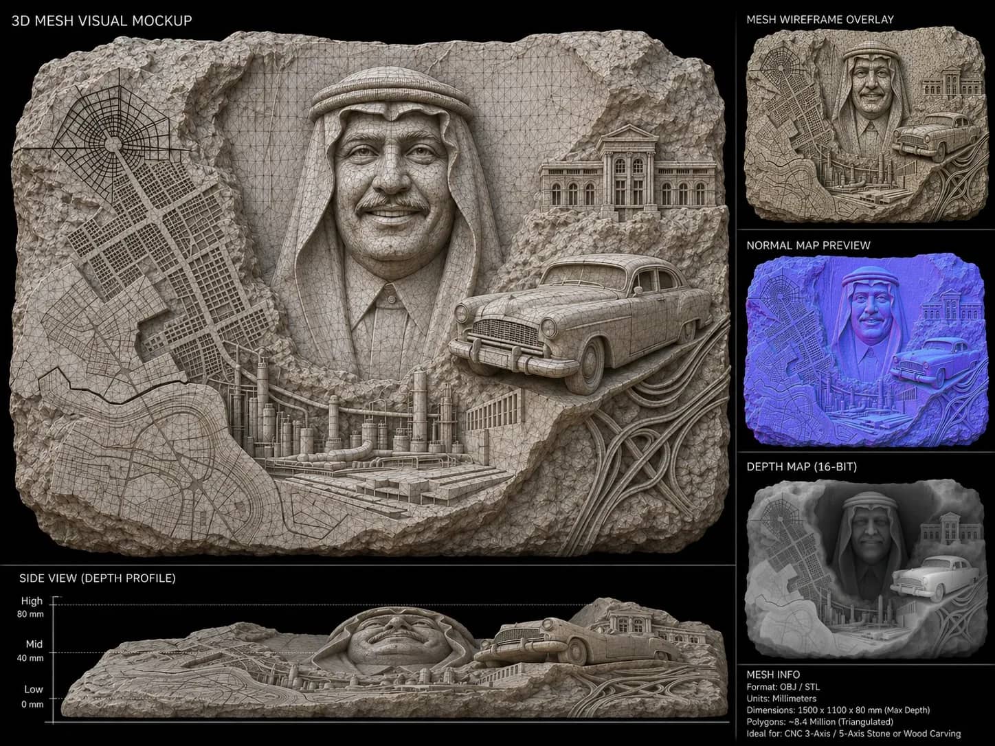
Every composition is developed through a layered fabrication workflow: historical research, urban extraction, architectural translation, 3D bas-relief modeling, CNC and stone carving, and physical installation. The final works are designed to exist physically, not only digitally.
Each piece is engineered with a clear depth hierarchy suitable for carving: primary highways as a deep recessed carve; secondary roads at mid-depth; local grids as fine etched detail; urban zones as raised surface; and the background as a flat plane.
Visual Language
The project combines architectural masterplanning, sculptural bas-relief, industrial design logic, cartographic abstraction, and physical fabrication methodology.
The resulting aesthetic sits between an urban planning model, a carved monument, an engineered artifact, and a museum installation.
About the Project
The studio explores the intersection of architecture, infrastructure, sculpture, manufacturing, and historical narrative. Using advanced digital workflows and fabrication methodologies, the work transforms large-scale systems into tactile physical objects.
Every piece is designed with manufacturability in mind, balancing artistic composition with the precision required for CNC carving, relief sculpture, and architectural fabrication. The goal is to create objects that feel permanent, monumental, and culturally significant.
“This is not simply a documentation project. It is an attempt to physically preserve the transformation of a region through sculptural form, translating urban growth, infrastructure, and industrial development into a lasting carved record of the Eastern Province's evolution.”